
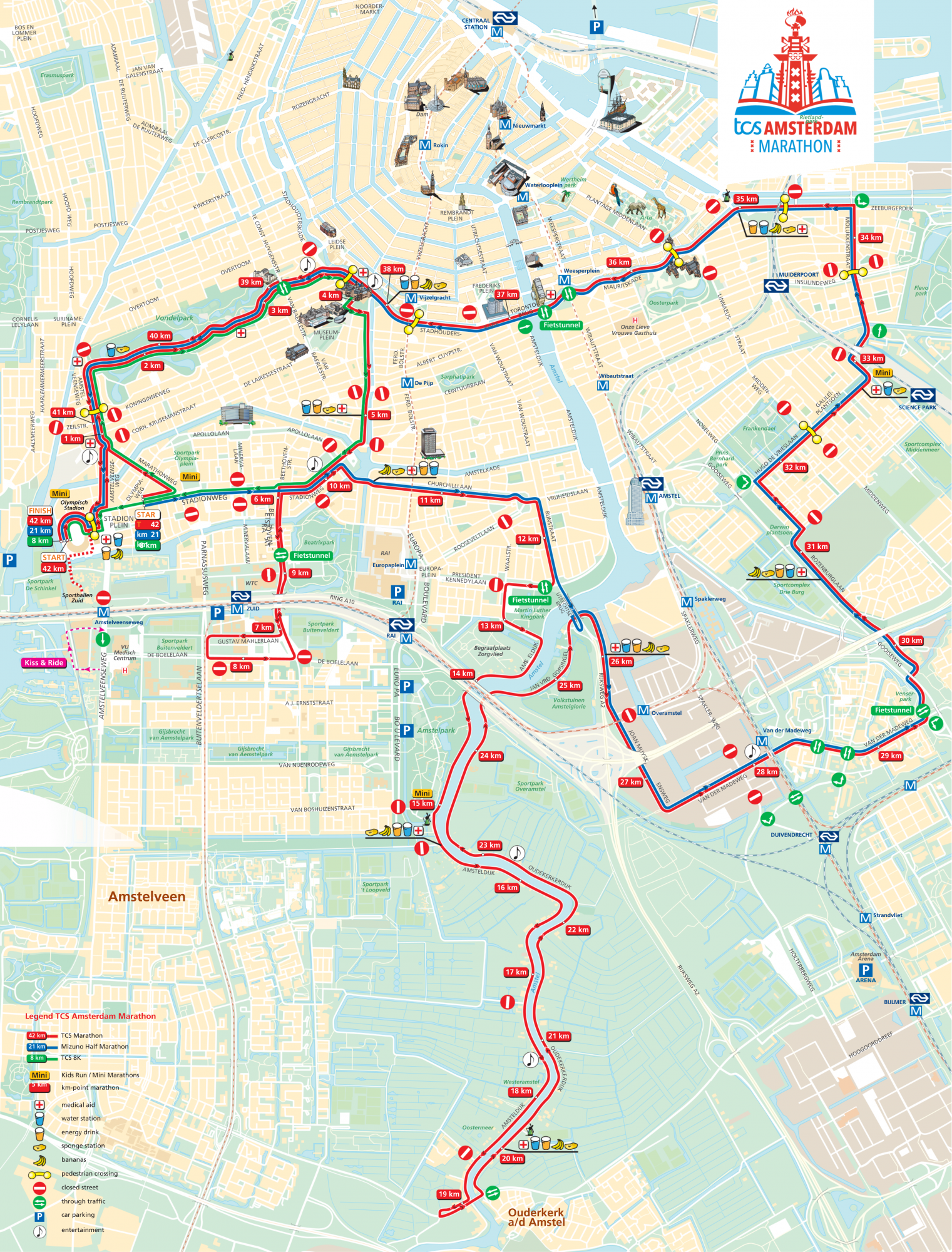
We will be meeting at all our usual times & locations on Sunday 20 October, but make sure you check your route to church as many roads are closed and some public transport services are not running.
It is possible to reach both the Vondelkerk & Thomaskerk.
Cycling
Check the route map for closed roads and crossing points (yellow connector symbols and green arrows show crossing points).
Cycle via the Piet Kranenbergpad to get to:
- Vondelkerk: from south of the Stadionweg/Churchill-laan
- Thomaskerk: from West
Public transport
Due to the TCS Marathon Amsterdam, many trams and buses will be diverted until 18:00. Tram 5, 14 and 24 and bus 65 do not run until 18.00. Check the GVB app or website to stay informed of the latest travel information, diversions and disruptions.
Driving
Check the route map to see which roads are closed. Gemeente Amsterdam has also published some helpful information regarding the road closures: amsterdam.nl/toerisme-vrije-tijd/evenementen/amsterdam-marathon
Vondelkerk (9.30 & 11.00)
Reaching the Vondelkerk by car should not be a problem when approaching from the west (Overtoom).
Zuid (17.00)
According to the route map, the Thomaskerk is difficult to access by car. However, being near the start of the route these roads should be reopened by the afternoon (the last starter group is at 9.30 and streets will be reopened to traffic again about 30 minutes after the last participant has passed). Parking in the area may be more difficult than usual though.